1918-DEC-18 |
1918-DEC-18 |
| WHITE RUSSIA FRANCE GREECE | |
|
|
|
| (Omsk) - (Paris) - (Athens a) - |
 |
Government of CRIMEA |
|
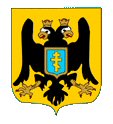
| Flag or logo since 1918-12-18* | Emblem or Symbol* |
|
| Capitals & administrative places*: | Bakhchisaray (Bakhtchyssaraï) |
|
| Official & national languages: | French (fr) . Russian (ru) . |
|
| CRIMEA | Government of CRIMEA (Bakhchisaray) |
| EUPATORIA | EUPATORIA Uyezd (Eupatoria) | Local: | YEVPATORIYSKIY uyezd : ЕВПАТОРИЙСКИЙ уезд (ru) (Evpatoria) |
| KERCH | KERCH City (Kerch) | Local: | Gorod KERCH : Город КЕРЧЬ (ru) (Kertch) |
| PEREKOP | PEREKOP Uyezd (Perekop) | Local: | PEREKOPSKIY uyezd : ПЕРЕКОПСКИЙ уезд (ru) (Perekop) |
| SEVASTOPOL | SEVASTOPOL City (Sevastopol) | Local: | Ville de SÉBASTOPOL (fr) + SEVASTOPOL Gorod : СЕВАСТОПОЛЬ Город (ru) (Sébastopol) |
| SIMFEROPOL | SIMFEROPOL Uyezd (Simferopol) | Local: | SIMFEROPOLSKIY uyezd : СИМФЕРОПОЛЬСКИЙ уезд (ru) (Simferopol) |
| THEODOSIA | THEODOSIA Uyezd (Theodosia) | Local: | FEODOSIYSKIY uyezd : ФЕОДОСИЙСКИЙ уезд (ru) (Feodossia) |
| YALTA | YALTA City (Yalta) | Local: | Gorod YALTA : Город ЯЛТА (ru) (Yalta) |
Other Independent or Semi-Independent Polities within the 2024's internationally recognized Country boundaries: |


