ethnia.org   
 

1907-JAN-02


INDIA  JAMMU AND KASHMIR  TANAWAL  UNITED KINGDOM 
    
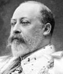
(Calcutta) - (Jammu w + Srinagar s) - (Amb r + Darband a + Phulra a) - (London a + Westminster lr + Edinburgh s + Windsor r) -

Country of TANAWAL
[Feudal Tanawal States]

Flag or logo since 1900-01-01*
FEUDAL TANAWAL States (en) + Mulk-e TANAWAL : الملک ت تانوال (ps) De facto Semi-Independent
Emblem or Symbol*

Viceroy Gilbert Elliot-Murray-Kynynmound
(ruler of INDIA since 1905-11-18)

Maharajah Sir Pratap Singh
(ruler of JAMMU AND KASHMIR since 1900-01-01)

Nawwab Muhammad Khani-Zaman Khan
(ruler of TANAWAL since 1907-01-02)

King Edward VII
(ruler of UNITED KINGDOM since 1901-01-22)


Capitals & administrative places*: Amb r + Darband a + Phulra a
(Amb + Darband + Phullra)
a administrative, national or political capital (also ruler's residence)
r ruler's residence (royal or presidential, primary or secondary)
Official & national languages: English (en) . Pashtun (ps) .

Mainland:


TANAWAL Country of TANAWAL  (Amb + Darband + Phulra)

2 Federated Divisions:

AMB Semi-Independent Kingdom of AMB [Tanawal Country]  (Amb + Darband)Local: State of AMB (en) + Rayast AMB : ریاست امب (pa) + Mulk-e TANAWAL : الملک ت تانوال (ps)  (Amb + Darband)
PHULRA Semi-Independent Khanate of PHULRA State  (Phulra)Local: PHULLRA State (en) + Ryast PHULERA : ریاست پھلرا (ur) + Mir-e PHULRAH : مير فاضله (ps)  (Phullra)


Dependent Protectorates:

AMB Semi-Independent Kingdom of AMB [Tanawal Country]  (Amb + Darband)Local: State of AMB (en) + Rayast AMB : ریاست امب (pa) + Mulk-e TANAWAL : الملک ت تانوال (ps)  (Amb + Darband)
PHULRA Semi-Independent Khanate of PHULRA State  (Phulra)Local: PHULLRA State (en) + Ryast PHULERA : ریاست پھلرا (ur) + Mir-e PHULRAH : مير فاضله (ps)  (Phullra)


* The emblems shown for the subdivisions may in some cases be those of their capital.

Other Independent or Semi-Independent Polities within the 2023's internationally recognized Country boundaries:

BALUCHISTAN BALUCHISTAN Agency [Princely States of Baloochistan]  (Kalat)
HUNZA Princely State of HUNZA [under Kashmiri Suzerainty]  (Baltit)
NAGAR Princely State of NAGAR [under Kashmiri Suzerainty]  (Nagar)


Other Territories or Entities within the 2023's internationally recognized Country boundaries:

BAGH BAGH Tehsil  (Bagh)
BAHAWALPUR Princely State of BAHAWALPUR [British Protectorate]  (Bahawalpur)
BAJUR Princely State of BAJUR : State of Nawagai  (Nawagai)
BALTISTAN BALTISTAN Division  (Skardu)
BATOGAH Shinaki Republic of BATOGAH  (Chilas)
BOLORISTAN BOLORISTAN Region  (Gakuch)
BRITISH BALUCHISTAN AND TRIBAL AREAS Chief Commissionner´s Province of BRITISH BALUCHISTAN AND TRIBAL AREAS  (Quetta)
BRITISH GILGIT GILGIT British Agency  (Gilgit + (Srinagar))
BUGTI COUNTRY BUGTI Tribal Agency  (Dera Bugti)
CHITRAL Princely State of CHITRAL [British Protectorate]  (Chitral)
DALBANDIN DALBANDIN Tribal Area  (Dalbandin)
DAREL DAREL Unadministered Tribal Area  (Domot)
DIR Princely State of the Khanate of DIR  (Dir)
DIR SWAT AND CHITRAL DIR SWAT AND CHITRAL Agency [Malakand Agency]  (Batkhela)
FRONTIER REGIONS FRONTIER REGIONS Districts  ((Peshawar))
FRONTIER STATES FRONTIER STATES Agency  (Wana)
GHIZER GHIZER State  (Ghizer)
GICHE Shinaki Republic of GICHE  (Giche)
GILGIT WAZARAT GILGIT WAZARAT Territory  (Astor + Gorikot)
GWADUR Governorate of GWADUR [Enclave in India]  (Gwadur)
HARBAN Shinaki Republic of HARBAN  (Harban)
HAZARA HAZARA Division  (Abbottabad)
HAZARA TRIBAL AREA HAZARA Unadministered Tribal Area  (Allai)
HAZARAS HAZARA Commission  (Jalkot)
HODAR Shinaki Republic of HODAR  (Hodar)
INDIAN MUSLIM LEAGUE ALL-INDIA Muslim League  (Lucknow)
INDUS KOHISTAN KOHISTAN Agency : Indus Kohistan Tribal Area  (Kalam)
ISHKOMAN Autonomous Province of ISHKOMAN  (Ishkuman)
JALKOT Shinaki Republic of JALKOT  (Jalkot)
JANDOOL JANDOOL Khanate  (Barwa)
KALAT Princely State of KALAT [British Protectorate of the Khanate of Kalat]  (Kalat + Khuzdar)
KHARAN KHARAN Vassal State of Kalat  (Kharan)
KHAYRPUR Princely State of KHAYRPUR [British Protectorate]  (Khayrpur)
KHILLI Shinaki Republic of KHILLI  (Khilli)
KHYBER KHYBER Agency : Khyber Special Area  (Landi Kotal)
KINERGAH Shinaki Republic of KINERGAH  (Kiner Gah)
KUH KUH State : State of Gupis  (Gupis)
KURRAM KURRAM Agency : Kurram Special Area  (Parachinar)
LASBELA Princely State of LAS BELA [British Protectorate]  (Bela)
MAKRAN MAKRAN Vassal State of Kalat  (Turbat-Kech)
MALAKAND TRIBAL MALAKAND Protected Area  (Mingora)
MARRI AND BUGTI COUNTRY TRIBAL AREAS of Beluchistan  (Sibi + Dera Bugti + Kohlu)
MARRI COUNTRY MARRI Tribal Agency  (Kohlu)
MIRPUR MIRPUR District  (Mirpur)
MUZAFFARABAD MUZAFFARABAD District  (Muzaffarabad)
NORTH-WEST FRONTIER Chief Commissionner´s Province of NORTH-WEST FRONTIER Province  (Peshawar)
NORTH-WEST FRONTIER STATES NORTH-WEST FRONTIER STATES Agency  (Batkhela)
POONCH POONCH State  (Poonch)
PUNIAL PUNIAL State  (Punial)
PUNJAB PUNJAB Province  (Lahore)
RAWALAKOT RAWALAKOT Tehsil  (Rawalakot)
SAZIN Shinaki Republic of SAZIN  (Sazin)
SEO Shinaki Republic of SEO  (Seo)
SHATIAL Shinaki Republic of SHATIAL  (Shatial)
SHIGAR SHIGAR State  (Shigar)
SHUMAR Shinaki Republic of SHUMAR  (Shumar)
SIND SIND Division  (Khurrachee)
SUDHNOTI SUDHNOTI Tehsil  (Palandri)
SWAT Islamic State of SWAT  (Saidu Sharif)
TANGIR TANGIR Unadministered Tribal Area  (Kami)
TOCHI NORTHERN WAZIRISTAN Agency [Tochi Tribal Area]  (Miram Shah)
TRANS-KARAKORAM TRANS-KARAKORAM Territory  (Shaksgam)
WANA SOUTHERN WAZIRISTAN Agency [Wana Tribal Area]  (Kaniguram + Wana)
WAZIRISTAN MOUNTAIN WAZIRISTAN MOUNTAIN Tract  (Kaniguram)
YASIN YASIN State [under Kashmiri Suzerainty]  (Yasin)
ZHOB District of ZHOB Tribal Area  (Zhob)
ethnia.org
   
Notes:


   ethnia.org aims to find the countries, territories, governments, administrative divisions and main international organisations that have existed during the 20th century.
   Current depth of investigation: . [red: country considered completed, rose: 1 level yet to complete, white: 2 levels yet to complete]
   For an idea on how was built the site, see the following documentary link of wikipedia [fr] : Modèle:Infobox


 General Internet Sources

   * Base géographique, Archives nationales d'outre-mer (FR). For the administrative divisions of the former French dependencies.
   * Centennia Historical Atlas Software, ed. Centennia (US). For Europe, North Africa and Middle East historical maps.
   * Drapeaux d'Origine & d'Inspiration Françaises - DO&IF, SFV (FR). For French colonial flags.
   * Ethnologue: Languages of the World, SIL International (US). For languages codes.
   * Flags Of The World - FOTW, Rob Raeside (CA). For the current and historic flags of the world.
   * GeoNames, Geonames (CH). Geographical names database.
   * Google Books, Google (US). Online library used for specific sources.
   * Herald Dick Magazine, Herald Dick (FR). For some current and historic arms.
   * Heraldry of the World, by Ralf Hartemink (NL). For local emblems and arms.
   * L'aménagement linguistique dans le monde, by Jacques Leclerc, University of Laval (CA). For national linguistic policies.
   * National Arms and Emblems - Past and Present, by Hubert de Vries (NL). For historic national emblems and arms.
   * Numismondo - World Printed Money Picture Catalog, by Garry Saint, Esquire (US). For national currencies.
   * Omniatlas - Interactive atlas of World History, by Rick Westera (NZ). For some geopolitical maps.
   * Perry-Castañ:eda Library Map Collection, University of Texas at Austin (US). For some historical maps.
   * Population Statistics, by Jan Lahmeyer (NL). For historical regional demographies and areas.
   * Portale Storia, by Giovanni Fontana (IT). For photos of rulers.
   * ReliefWeb, by the United Nations Office for the Coordination of Humanitarian Affairs (OCHA). For maps of some administrative divisions.
   * Rulers.org, by Benjamin Schemmel (DE). For photos of rulers.
   * Statoids, by Gwillim Law (US). For historical administrative subdivisions.
   * The World Factbook, ed. Central Intelligence Agency (US). For the general data and profiles of the current countries.
   * United Nations Peacekeeping, United Nations (UNO). For the United Nations Missions.
   * Vexilla Mundi, by Mello Luchtenberg (NL). For flags of the world.
   * Vexillographia, by Viktor Lomantsov (RU). For flags of Russia and Soviet Union.
   * Wikimedia Commons, Wikimedia Foundation (US). Free-use pictures.
   * Wikipedia, Wikimedia Foundation (US). For general data, maps, sources, pictures.
   * World Heritage Centre, (UNESCO). For the selected photos of the countries.
   * World History at KMLA, by Alexander Ganse (DE). For historical maps and links by country.
   * World Statesmen, by Ben Cahoon (US). Main source for the historical polities and their rulers.

 General Printed References

   * Atlas des empires and other books of Gérard Chaliand, ed. Payot (FR). General historical geopolitic data.
   * Atlas of the World's Languages, ed. Routledge (UK). Most complete world list of languages and dialects.
   * Flags Through the Ages and Accross the World, by Whitney Smith, ed. McGraw (US). Flags of the world.
   * Fragments d'Europe, by Michel Foucher, ed. Fayard (FR). For the post-Soviet Union polities.
   * L'État du Monde, ed. La Découverte (FR). Yearly geopolitic cover of the world.
   * Quid, by Dominique Frémy, ed. Plon (FR). Yearly encyclopedia that was useful for countries data.
   * Statoids printed version, by Gwillim Law (US). For historical administrative subdivisions.
   * The Times Atlas of the World, ed. Times Atlas (UK). Periodical atlas of the world with its supplementary list of administrative subdivisions.
   * World Christian Encyclopedia, by David B. Barrett, ed. Oxford University Press (UK). For world religious groups but also ethnological data. First inspiring source of Ethnia.org website's look.
   * World Paper Money, ed. Krause (US). For historical currencies.

    + the other sources are added according to the consulted entity.


Please feel free to send your own informations or suggestions to .


 Drawn with Inkscape  Written with Notepad++  Powered by Apache  ethnia.org Creative Commons License CC-BY Archived since 2003 by Internet Archives
Thank you.
UPDATED ON: ~ 2023-APR-27 ~ .