2016-FEB-07 |
2016-FEB-07 |
| ARAKAN (Kayin) | Arakan National Council : ANC : | Ko Naing Soe | ||||
| ARAKAN LEAGUE (Laiza g) | United League of Arakan : ULA : | Tun Myat Naing | ||||
| ROHINGYA (London + Cox´s Bazar) | Rohingya National Council : RNC : | Nurul Islam | ||||
| ISLAMIC ARAKAN (Harakah Al-Yaqin) | Faith Movement of Arakan : HARAKAH AL-YAQIN : | Ataullah Abu Ammar Jununi | ||||
| FREE ARAKAN (Karen Camps) | Arakan Liberation Party : ALP : | U Khine Ray Khine | ||||
| RAKHINE (Sittwe) | RAKHINE State : |
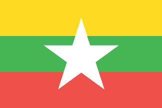
| Republic of the Union of Myanmar : UOM | |
 |
|
| (Naypyidaw a + Rangoon bn) |
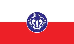 |
RAKHINE State |

|
| Flag or logo since 2013-02-19* | Emblem or Symbol* |
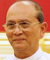 President Thein Sein (ruler of MYANMAR since 2011-03-30) |
| Capitals & administrative places*: | Sittwe (Sittway) |
|
| Official & national languages: | Burmese (my) . Arakanese (rki) . |
|
| KYAUKPYU | KYAUKPYU District (Kyaukpyu) | Local: | KYAUKPHYU Hkarine : ကျောက်ဖြူခရိုင် (my) + KYAUNKPYU Hkarine : ကျောက်ဖြူခရိုင် (rki) (Kyaukphyu) |
| MAUNGDAW | MAUNGDAW District (Maungdaw) | Local: | MAUNG:TAU Hkarine : မောင်တောခရိုင် (my) + MAUNGDAW Hkarine : မောင်တောခရိုင် (rki) (Maungtau) |
| MRAUK-U | MRAUK-U District (Mrauk-U) | Local: | MRAUK-U Hkarine : မြောက်ဦးခရိုင် (my) + MRAUK-U Hkarine : မြောက်ဦးခရိုင် (rki) (Mrauk-U) |
| SITTWE | SITTWE District (Sittwe) | Local: | CAC TWE Hkarine : စစ်တွေခရိုင် (my) + SACTWE Hkarine : စစ်တွေခရိုင် (rki) (Sittway) |
| THANDWE | THANDWE District : Sandoway District (Thandwe) | Local: | SAMTWAI Hkarine : သံတွဲခရိုင် (my) + THANDWAY Hkarine : သံတွဲခရိုင် (rki) (Samtwai) |
Other Independent or Semi-Independent Polities within the 2024's internationally recognized Country boundaries: |
