1943-DEC-01 |
1943-DEC-01 |
| Great Empire of JAPAN | |
 |
|
| (Tokyo) |
 |
Japanese Occupied Territory of NEW GUINEA ISLANDS |

|
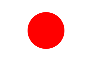
| Flag or logo since 1942-01-21* | Emblem or Symbol* |
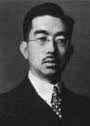 Emperor Hirohito (ruler of JAPAN since 1926-12-25) |
| Capitals & administrative places*: | Rabaul (Rabauru) |
|
| Official & national languages: | Japanese (ja) . |
|
| NEW GUINEA ISLANDS | Japanese Occupied Territory of NEW GUINEA ISLANDS (Rabaul) |
| NEW GUINEA | NEW GUINEA Zone (Madang) | Local: | NIYUGINIA Chiiki : ニューギニア地域 (ja) (Madang) |
| NEW GUINEA ISLANDS | NEW GUINEA ISLANDS Area (Rabaul) | Local: | NIYUGINIA SHIMA no Ryodo : ニューギニア島の領土 (ja) (Rabauru) |
| SOLOMON ISLANDS | Japanese Military District of SOLOMON ISLANDS (Buka) | Local: | SOROMON-SHIMA Chiku : ソロモン諸島 地区 (ja) (Buka) |
Other Territories or Entities within the 2024's internationally recognized Country boundaries: |
| AUSTRALIAN NEW GUINEA | AUSTRALIAN NEW GUINEA Administrative Unit (Port Moresby) |
| CAPE TOROKINA | CAPE TOROKINA Territory (Torokina) |
| CENTRAL HIGHLANDS | CENTRAL HIGHLANDS Division (Mount Hagen) |
| MOROBE | MOROBE Division (Finschaven) |
| PAPUA | Military Administration of the Territory of PAPUA (Port Moresby) |
| SOUTH EASTERN PAPUA | SOUTH EASTERN Division (Alotau) |
| |
|
|
ethnia.org © J.-M. Merklin |
|

|