1983-NOV-08 |
1983-NOV-08 |
| Republic of PANAMA [Military Government] | DARIEN Province | |
 |
 |
|
| (Panama City) | (La Palma) |
 |
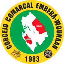
Sub-Provincial Comarca EMBERA OF DARIEN |
|
| Flag or logo since 1983-11-08* | Emblem or Symbol* |
 General Manuel Noriega (ruler of PANAMA since 1983-08-12) |
| Capitals & administrative places*: | Cirilo Guainora (Cirilo Guainora) |
|
| Official & national languages: | Spanish (es) . |
|
| CEMACO | CEMACO District (Cirilo Guainora) | Local: | Distrito de CÉMACO (es) (Cirilo Guainora) |
| SAMBU | SAMBU District (Puerto Indio) | Local: | Distrito de SAMBÚ (es) (Puerto Indio) |
Other Independent or Semi-Independent Polities within the 2024's internationally recognized Country boundaries: |
| PANAMA | Republic of PANAMA [Military Government] (Panama City) |
Other Territories or Entities within the 2024's internationally recognized Country boundaries: |
| BOCAS DEL TORO | BOCAS DEL TORO Province [Mouths of the Bull] (Bocas Town) |
| CARIBBEAN SIDE OF PANAMA | Districts of Chagres and Donoso : CARIBBEAN SIDE OF PANAMA (New Chagres + San Miguel de la Borda) |
| CHIRIQUI | CHIRIQUI Province (San Jose of David) |
| COCLE | COCLE Province (Penonome) |
| COLON FREE ZONE | Colon Free Trade Zone : COLON FREE ZONE (Colon Free Zone) |
| HERRERA | HERRERA Province (Chitre) |
| LOS SANTOS | LOS SANTOS Province [The Saints Province] (Las Tablas) |
| PANAMA CANAL | PANAMA CANAL Commission (Balboa Heights) |
| PANAMA CANAL ZONE BASES | PANAMA CANAL ZONE Bases [Panamanian Lease to United States] (Howard Air Force Base + Albrook Air Force Station) |
| SAN BLAS | Comarca of SAN BLAS (El Porvenir) |
| SAN BLAS ARCHIPELAGO | Islands of SAN BLAS ARCHIPELAGO (Acuadup) |
| TERIBE | Traditional Kingdom of TERIBE (Sieyic) |
| VERAGUAS | VERAGUAS Province (Santiago of Veraguas) |
| WEST PANAMA | Districts of WEST PANAMA (La Chorrera) |
| |
|
|
ethnia.org © J.-M. Merklin |
|

|