2003-DEC-01 |
2003-DEC-01 |
| Republic of THE SUDAN | Coordinating Council of the SOUTHERN STATES | |
 |
 |
|
| (Khartoum) | (Juba) |
 |
BAHR EL-JEBEL State |

|
| Flag or logo since 1991-01-01* | Emblem or Symbol* |
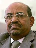 President Omar Al-Bashir (ruler of SUDAN since 1989-06-30) |
| Capitals & administrative places*: | Juba (Juba) |
|
| Official & national languages: | Arabic (ar) . English (en) . |
|
| JUBA | JUBA County (Juba) | Local: | JUBA (Juba) |
| TEREKEKA | TEREKEKA County (Terekeka) | Local: | TEREKEKA (Terekeka) |
| YEI | YEI County (Yei) | Local: | YEI (Yei) |
Other Independent or Semi-Independent Polities within the 2024's internationally recognized Country boundaries: |
| SOUTH SUDAN | Sudan People´s Liberation Movement : SPLM (Bilpham g) |
Other Territories or Entities within the 2024's internationally recognized Country boundaries: |
| AKOBO | AKOBO County (Akobo) |
| BUHEYRAT | LAKES State (Rumbek) |
| EAST EQUATORIA | EAST EQUATORIA State (Kapoeta) |
| ILEMI TRIANGLE | Territory of ILEMI TRIANGLE [Kenyan Administration of the Sudanese Territory] (Ilemi) |
| JUNGOLI | JUNGOLI State (Bor) |
| KAFIA KINGI | KAFIA KINGI District [Disputed Area part of Buram Province in Darfur] (Kafia Kingi + Hofrat Al-Nahas) |
| LIWAN | CENTRAL ILEMI Area [Pro-Ethiopian Dassanetch Control] (Liwan) |
| NAMURUPUTH | NAMURUPUTH Territory (Namuruputh) |
| NORTH BAHR EL GHAZAL | NORTH BAHR EL GHAZAL State (Aweil) |
| SHILLUKLAND | State of the Shilluk Kingdom of CHOLLO (Kodok) |
| SOUTHERN SUDAN | Coordinating Council of the SOUTHERN STATES (Juba) |
| UNITY | UNITY State (Bantiu) |
| UPPER NILE | UPPER NILE State (Malakal) |
| WARRAP | WARRAP State (Warrap + Kuajok) |
| WATHA PETH HILLS | Sudan Patrol Line Area : WATHA PETH HILLS Area (Lokwor) |
| WEST EQUATORIA | WEST EQUATORIA State (Yambio) |
| WESTERN BAHR EL GHAZAL | WESTERN BAHR EL GHAZAL State (Wau) |
| |
|
|
ethnia.org © J.-M. Merklin |
|

|