1958-MAR-22 |
1958-MAR-22 |
| Republic of THE SUDAN [Sudanese Sovereignty Council] | |
 |
|
| (Khartoum) |
 |
BAHR EL GHAZAL Province : Directorate of Bahr El Ghazal |

|
| Flag or logo since 1948-01-01* | Emblem or Symbol* |
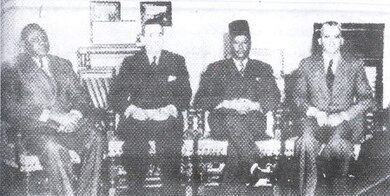 Sovereignty Council (ruler of SUDAN since 1956-01-01) |
| Capitals & administrative places*: | Wau (Wāw) |
|
| Official & national languages: | Arabic (ar) . English (en) . |
|
| AWEIL | AWEIL County (Aweil) | Local: | Mudiriya UWAYL (Uwayl) |
| BUHEYRAT | LAKES Region : El Buheyrat Region (Rumbek) | Local: | EL BUHEYRAT Region (Rumbek) |
| WARRAP | WARRAP Region (Warrap) | Local: | WARAB Region (Warab) |
| WESTERN BAHR EL GHAZAL | WESTERN BAHR EL GHAZAL Region (Wau) | Local: | GHARB BAHR AL-GHAZAL Region (Wāw) |
Other Independent or Semi-Independent Polities within the 2024's internationally recognized Country boundaries: |
| SOUTHERN SUDAN | Southern Sudan Federal Party : SSFP [Southern Sudan Guerilla] ((Juba)) |
Other Territories or Entities within the 2024's internationally recognized Country boundaries: |
| BLUE LINE AREA | Blue Line Area in CENTRAL ELEMI Triangle (Liwan) |
| ELEMI TRIANGLE | ELEMI TRIANGLE Zone [British Kenyan Administration] (Kamachia) |
| EQUATORIA | EQUATORIA Province : Equatoria Directorate (Juba) |
| SHILLUKLAND | State of the Shilluk Kingdom of CHOLLO (Kodok) |
| UPPER NILE | UPPER NILE Province : Upper Nile Directorate (Malakal) |
| WATHA PETH HILLS | Sudan Patrol Line Area : WATHA PETH HILLS Area (Lokwor) |
| |
|
|
ethnia.org © J.-M. Merklin |
|

|