1970-MAY-20 |
1970-MAY-20 |
| Democratic Republic of THE SUDAN [Revolutionary Command Council] | UPPER NILE Province : Upper Nile Directorate | EASTERN UPPER NILE Region | FASHODA County | |
 |
 |  |  |
|
| (Khartoum) | (Malakal) | (Malakal) | (Kodok) |
 |
State of the Shilluk Kingdom of CHOLLO |

|
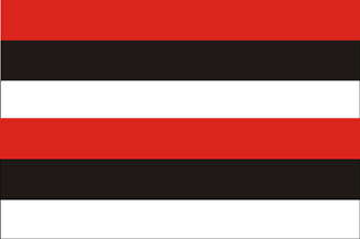
| Flag or logo since 1900-01-01* | Emblem or Symbol* |
 Gaafar Muhammad Numairy (ruler of SUDAN since 1969-05-25) |
| Capitals & administrative places*: | Kodok (Pachodo) |
|
| Official & national languages: | Arabic (ar) . English (en) . Shilluk (shk) . |
|
| FASHODA | FASHODA Vicinity (Kodok) | Local: | FASHODA Area (Pachodo) |
| MANYO | MANYO Vicinity (Manyo) | Local: | MANYO Area (Manyo) |
| PANYKANG | PANYKANG Vicinity (Panykang) | Local: | PANYIKANG Area (Panyikang) |
Other Independent or Semi-Independent Polities within the 2024's internationally recognized Country boundaries: |
| AFRICAN SUDAN | Sudan African National Union : SANU [Southern Sudan Guerilla] (Kampala) |
| NILE STATE | Nile Provisional Government-in-Exile : NILE STATE (Kampala x) |
Other Territories or Entities within the 2024's internationally recognized Country boundaries: |
| BAHR EL GHAZAL | BAHR EL GHAZAL Province : Directorate of Bahr El Ghazal (Wau) |
| BLUE LINE AREA | Blue Line Area in CENTRAL ILEMI Triangle (Liwan) |
| DEIM ZUBEIR | DEIM ZUBEIR County [Anyanya Rebellion] (Deim Zubeir) |
| EQUATORIA | EQUATORIA Province : Equatoria Directorate (Juba) |
| ILEMI TRIANGLE | ILEMI TRIANGLE Zone [Kenyan Administration] (Kamachia) |
| NAMURUPUTH | NAMURUPUTH Territory (Namuruputh) |
| UPPER NILE | UPPER NILE Province : Upper Nile Directorate (Malakal) |
| WATHA PETH HILLS | Sudan Patrol Line Area : WATHA PETH HILLS Area (Lokwor) |
| |
|
|
ethnia.org © J.-M. Merklin |
|

|