1939-FEB-06 |
1939-FEB-06 |
| BRITISH COMMONWEALTH of Nations [British Colonial Empire] | British Colony of BURMA | MANDALAY Division | MYITKYINA District | |
 |
 |  |  |
|
| (London a + Westminster lr + Edinburgh s + Windsor r) | (Rangoon a) | (Mandalay) | (Myitkyina) |
 |
MYITKYINA Township |

|
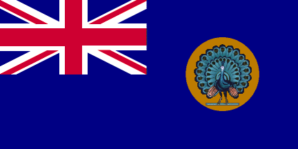
| Flag or Logo since 1939-02-06 | (Emblem or Symbol of BURMA) |
 King George VI (ruler of UNITED KINGDOM since 1936-12-11) |
| Capitals & administrative places: | Myitkyina (Myitkyina) |
|
| Official & national languages: | English (en) . |
|
| EASTERN KACHIN HILLS | EASTERN KACHIN HILLS Area (Gawlam + Hpimaw + Kanfang) | Local: | EASTERN KACHIN HILLS Area (Gawlam + Hpimaw + Kanfang) |
| FORT HERTZ | FORT HERTZ Township (Fort Hertz) | Local: | FORT HERTZ Township (en) (Fort Hertz) |
| KACHIN HILLS | KACHIN HILLS Area (Sima) | Local: | KACHIN HILLS Area (en) (Sima) |
| MYITKYINA | MYITKYINA Township (Myitkyina) | Local: | MYITKYINA Township (en) (Myitkyina) |
Other Territories or Entities within the 2024's internationally recognized Country boundaries: |
