1941-JUN-25 |
1941-JUN-25 |
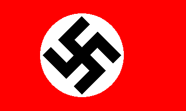
| Greater German Empire : GERMANY [Nazi Germany Third Reich] | German Occupied Territory of MACEDONIA AND AEGEAN | |
 |
 |
|
| (Berlin a + Berchtesgaden r + Forst Goerlitz fm) | (Thessalonica) |
 |
SAMOS Prefecture |

|
| Flag or logo since 1941-06-25* | Emblem or Symbol* |
 Reichpresident Fuhrer Adolf Hitler (ruler of GERMANY since 1934-08-02) |
| Capitals & administrative places*: | Samos-Vathy (Samo-Vathi) |
|
| Official & national languages: | German (de) . |
|
| SAMOS | SAMOS Prefecture (Samos-Vathy) |
| SAMOS | SAMOS Island (Samos-Vathy) | Local: | SAMOS Insel (Samos-Vathy) |
Other Independent or Semi-Independent Polities within the 2024's internationally recognized Country boundaries: |
| FREE GREECE | National Liberation Front of GREECE (Konitsa) |
| GREEK STATE | GREEK State [Hellenic State] (Athens a) |
Other Territories or Entities within the 2024's internationally recognized Country boundaries: |
| AEGEAN SEA ISLANDS | Italian Possessions of AEGEAN SEA ISLANDS (Rhodes) |
| CERIGO | CERIGO Islands (Cythera) |
| CHAMERIA | CHAMERIA Governorate (Igoumenitsa) |
| CHIOS | CHIOS Prefecture (Chios) |
| CYCLADES | CYCLADES Prefecture (Hermoupolis) |
| EASTERN MACEDONIA AND WESTERN THRACE | Bulgarian Military Territory of EASTERN MACEDONIA AND WESTERN THRACE (Komotini) |
| EPIRUS | Albanian Region of EPIRUS (Jannena) |
| IONIAN ISLANDS | IONIAN ISLANDS Region (Corcyra) |
| LASITHI | LASITHI Prefecture [Italian Occupation] (Saint Nicholas) |
| LESBOS | LESBOS Prefecture (Mytilene) |
| MACEDONIA AND AEGEAN | German Occupied Territory of MACEDONIA AND AEGEAN (Thessalonica) |
| MOUNT ATHOS | Monastic State of MOUNT ATHOS [German Occupation] (Karyes) |
| PIRAEUS | Port of PIRAEUS (Piraeus) |
| SALAMIS ISLANDS | SALAMIS ISLANDS Group (Salamis) |
| SOUTHERN GREECE | German Military Territory of SOUTHERN GREECE (Candia) |
| |
|
|
ethnia.org © J.-M. Merklin |
|

|