1944-OCT-17 |
1944-OCT-17 |
| Democratic Federative Yugoslavia : DFY [Democratic Federation of Yugoslavia] | |
 |
|
| (Vis g) |
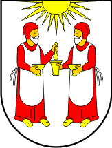 |
Archipelago of LAGOSTA |

|
| Flag or logo since 1900-01-01* | Emblem or Symbol* |
 Marshal Josip Broz Tito (ruler of YUGOSLAVIA since 1943-11-29) |
| Capitals & administrative places*: | Lagosta (Lastovo) |
|
| Official & national languages: | Serbocroatian (sh) . |
|
| CAZZA | CAZZA Island (Samo Svjetionik) | Local: | SUŠAC (Samo Svjetionik) |
| LAGOSTA | LAGOSTA Island (Lagosta) | Local: | LASTOVO (Lastovo) |
Other Independent or Semi-Independent Polities within the 2024's internationally recognized Country boundaries: |
| CROATIA | Independent State of Croatia : NDH [Ustashe Croatia] (Zagreb) |
Other Territories or Entities within the 2024's internationally recognized Country boundaries: |
| BREZOVITSA ZUMBERACHKA | BREZOVITSA ZUMBERACHKA Enclave in Ozalj Municipality (Brezovitsa Zumberachka) |
| CARNARO | German Occupied Province of CARNARO (Fiume) |
| ISTRIA | Province of ISTRIA [German Occupation under Italo-Croatian Administration] (Pula) |
| MIDDLE MURANIA | MIDDLE MURANIA County (Tschakathurn) |
| PELAGOSA | Archipelago of PELAGOSA (Greater Pelagosa) |
| SOUTHERN BARANYA | SOUTHERN BARANYA Region (Beli Manastir) |
| TRANSDRAVA | Partisan Republic of TRANSDRAVA (Koprivnica) |
| VIS | VIS Island (Vis) |
| YUGOSLAV CROATIA | Federal State of CROATIA [Anti-Fascist Council of National Liberation of Croatia] (Sisak) |
| ZARA | Province of ZARA (Zara) |
| |
|
|
ethnia.org © J.-M. Merklin |
|

|