1964-SEP-07 |
1964-SEP-07 |
| CONGO-LEOPOLDVILLE (Leopoldville a) | The Democratic Republic of the Congo : DRC : | President Joseph Kasavubu | ||||
| CONGO-BRAZZAVILLE (Brazzaville a) | Republic of CONGO : | President Alphonse Massemba-Debat | ||||
| CONGO-STANLEYVILLE (Stanleyville) | People´s Republic of the CONGO : | President Christophe Gbenye |
| People´s Republic of the CONGO | |
 |
|
| (Stanleyville) |
|
People´s Republic of the CONGO |

|
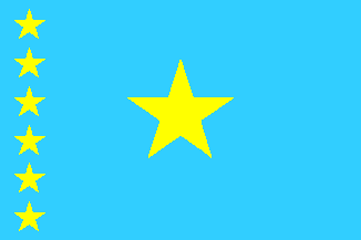
| Flag or logo since 1964-09-07* | Emblem or Symbol* |
 President Christophe Gbenye (ruler of CONGO-STANLEYVILLE since 1964-09-07) |
| Capitals & administrative places*: | Stanleyville (Stanleyville) |
|
| Official & national languages: | French (fr) . |
|
| CONGO-STANLEYVILLE | People´s Republic of the CONGO (Stanleyville) |
| EAST | EAST Province (Stanleyville) | Local: | Province ORIENTALE (fr) (Stanleyville) |
| KIBALI-ITURI | KIBALI-ITURI Province (Bunia) | Local: | Province de KIBALI-ITURI (fr) (Bunia) |
| MANIEMA | MANIEMA Province (Kindu-Port Empain) | Local: | Province du MANIEMA (fr) (Kindu-Port-Empain) |
| MIDDLE CONGO | MIDDLE CONGO Province (Lisala) | Local: | Province du MOYEN-CONGO (fr) (Lisala) |
| SANKURU | SANKURU Province (Lodja) | Local: | Province de la SANKURU (fr) (Lodja) |
| TSHUAPA | TSHUAPA District (Boende) | Local: | District de la TSHUAPA (fr) (Boende) |
| UBANGI | UBANGI Province (Gemena) | Local: | Province de l´UBANGI (fr) (Gemena) |
| WELE | WELE Province (Paulis) | Local: | Province de l´UELE (fr) (Paulis) |
| BUKAVU | Republic of BUKAVU (Bukavu) | Local: | République de BUKAVU (fr) (Bukavu) |
| MAI-MAI | Simba Mai-Mai Rebellion in KWILU (Idiofa) | Local: | Rébellion SIMBA (fr) + Uasi wa SIMBA (sw) (Idiofa) |
Other Independent or Semi-Independent Polities within the 2024's internationally recognized Country boundaries: |
| CONGO-LEOPOLDVILLE | The Democratic Republic of the Congo : DRC (Leopoldville a) |
| LUALABA | State of LUALABA (Kolwezi) |
Other Territories or Entities within the 2024's internationally recognized Country boundaries: |
